On November 15, 2019, the City of Seattle adopted a new Known Landslide map and an updated map for steep slope erosion hazard areas. The layer will be available in early December on SDCI’s GIS map. Known landslide areas and steep slope erosion hazard areas are Environmentally Critical Areas regulated by SMC 25.09.
We developed the new Known Landslide map from a detailed evaluation of the City’s extensive historical database of landslide records. We included the landslide initiation points identified in the Seattle Landslide Study and parcels that have been affected by reported landslides. Here is an example of the previous known landslide layer and the new layer:
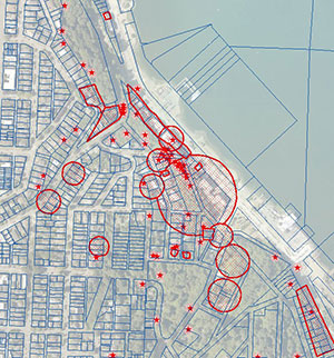
Previous Known Landslide Layer
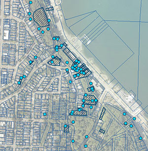
New Known Landslide Layer
When you click on a landslide feature, you will find a brief description of the landslide as well as a .pdf of the scanned paper landslide file. You can read more about how we developed the new Known Landslide layer in Director’s Rule 12-2019.
The update to the steep slope erosion hazard areas included removing some mis-mapped areas of steep slopes.
