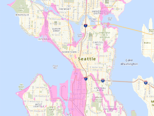
 SDCI has updated the Environmentally Critical Areas (ECA) Map for Liquefaction-Prone areas. Liquefaction occurs when loose, saturated soils lose their strength due to strong ground shaking (usually from earthquakes). Details of the update are described in Director’s Rule 2-2023, Update of ECA Liquefaction-Prone Areas Map, which was effective August 30, 2023. You can view the new liquefaction-prone ECA layer on our GIS map.
The previous liquefaction-prone areas map was based on the 1962 geologic map of Seattle and ground shaking from smaller earthquakes. The current map is based on the 2005 geologic map of Seattle and updated earthquake ground motions. The map is advisory, meaning that SDCI uses it as a tool for screening; however, permit application reviews are based on site-specific information.
